The island of Bali is 153 km east to west and roughly 112 km north to south. It is mountainous in the centre and on the eastern side. Bali has one large active volcano that last blew in 1963. As you'll see on the map, Bali has major coastal roads all around the island. As seen on the map below the roads that run through the centre of the island run north to south and tend to run along mountain ridges.
Bali is surrounded by reefs and is a great place for snorkelling and diving. The beaches in the south have white sand while beaches in the north and west have black sand. To the right of this map is the large island of Lombok and the smaller Gili Islands. Where is your hotel located? Check out our hotel location map.
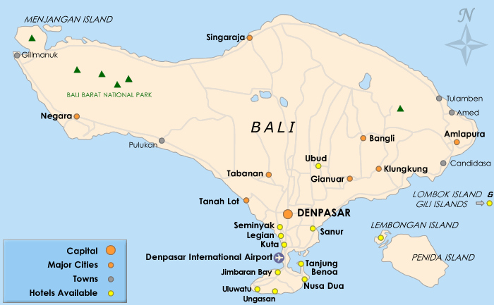
The largest city and capital and capital of Bali is Denpasar. Close to the centre of the main island, Ubud has an art market, museums and galleries and is considered the cultural heart of Bali.
Bali has 3 main tourist regions. The Seminyak, Legian and Kuta region as seen on the map is the main tourist area with a huge a range of hotels and resorts with several budget and luxury options - Kuta is the main Bali party area. Nusa Dua has a selection of up market hotels - an exclusive area with three golf courses. Hotels found in Sanur are luxurious and the area is suited to visitors seeking peace and quiet.